Sunday, June 26, 2011

The Greatest Journey -- Out of the Outback

I always hate leaving the Outback whenever I travel in Australia. To me, it somehow seems like the end of the journey, no matter what lies ahead. It was today that Isabella and I would be re-entering so-called "Civilized Australia" but I couldn't help feel a pang of sadness as we drove, knowing that our adventures in the Outback were over.

After awaking and having a quick breakfast, Isabella and I continued south along the Stuart. The aboriginal people who had camped the night before had moved on. We encountered their convoy on the way south to Coober Pedy and we later learned that there was some important cultural gathering happening in the hills around Coober Pedy. We can only assume that that's where they were headed.

Along the road to Coober Pedy we stopped at an inconspicuous fence crossing the highway. It doesn't look important, much like any other boundary demarcating fence, but this one is special for 2 reasons: it crosses the highway (which is unusual) and it's part of the longest fence in the world. This is the famous Dingo Fence that stretches more than 5 000 kilometers from the Great Australian Bight to southern Queensland. It is about 2 000 kilometers longer than the Great Wall of China.

The Dingo Fence, or Dog Fence or Vermin Proof Fence, was built by pastoralists who wanted to protect their flocks from ravenous dingoes. On the south side of the fence there tend to be sheep but on the north side there tend to be cattle, which are too big for a dingo to tangle with. It continues to be maintained by farmers and does, at least to some extent, keep out the dingoes.

After our brief highway stop, Isabella and I continued to Coober Pedy. We stopped there and took a brief trip down the Oodnadatta Track, nothing more than a flattened dirt road, to where the Dingo Fence crosses that road. The weather-beaten sign says that the fence extends to Surfers Paradise in Queensland but I suspect that is for tourists. As far as I can tell, the fence ends in Jambour significantly further inland. I suppose statements written on signs aren't written under oath.

At this point there is also the Moon Plain, a barren featureless expansive void of rock. It is aptly named as standing alone on the Moon Plain gives a sense of complete desolation and isolation. If not for the Oodnadatta Track, no one would dare cross this place.

After leaving this harsh place, Isabella and I returned to the Stuart Highway and continued south. Along the way we stopped for lunch at Pimba, the roadside gas station that serves as an entrance to Woomera. It was here that I remembered why I liked eating in remote Australian locales --- the portions. I ordered a t-bone steak and even though the meal cost $22, the steak was quite large. It was something I had noticed when travelling in Tasmania as well. Having dined heartily, Isabella and I continued south towards Port Augusta, and somewhere along the way, though no one can say where exactly, we left the Outback.

We drove into Port Augusta in the early evening and decided to take a stroll around the town. There really wasn't much to it but Isabella had a guide book that gave a self-guided tour of the city. We walked by many old buildings and some places where buildings had one stood but had since been demolished. There were even the remains of an old ship near the harbour. We also walked by Port Augusta's landmark domed Town Hall but on closer inspection, it looked rather run down. Having seen a few photos of it, though from farther away, I thought the Town Hall would be better maintained but I guess times are hard in Port Augusta.

Isabella and I decided to camp in the Mount Remarkable National Park, a way to the south of Port Augusta. We decided to camp in the back area of the park, as had many others it seemed. I thought the most interesting part was that to pay for the night you take an envelope from the park entrance, put in the appropriate amount, fill in your vehicle details and then deposit it in a box at the entrance. This was all new to me but Isabella knew the procedure well as a park employee. We settled down for the night in our tent under a large tree. After some fairly exhausting days of driving, tomorrow's drive to Adelaide would be short and we'd have a chance to hike in the park.


Saturday, June 18, 2011

The Greatest Journey -- The Greatest Rock

Perhaps Australia's greatest geographic landmark is Uluru, formerly known as Ayers Rock. It is just so iconic of Australia and so unlike any other feature on Earth. To photograph it is unmistakeable proof that you were in Australia. Uluru sits in the heart of the Australian continent and the Australian psyche. For many aboriginal groups it is a symbol of their culture while all Australians in general have adopted it as a powerful symbol of their country.

Alice Springs and Uluru are so closely associated in most peoples' minds that few give a thought to how far apart the 2 actually are. Alice Springs is 460 kilometers away from Uluru; 200 kilometers down the Stuart Highway to Erldunda Roadhouse and then 260 kilometers down the Lasseter Highway. In order for us to see the rock, Isabella and I had to set out at 06:00. This was going to be our longest driving day and we had quite a site to see.

So we set off from Alice Springs along the road we had travelled only a few days before. As we headed south we sped along and made it to Erldunda in short order. I then steered the car onto the Lasseter and we continued towards the rock. The wonderful thing about the highway is that with so little traffic, you can really get some speed and on one occasion I even made it just past 180 km/h! So as we flew down the road we saw Mt. Conner to the south, a sort of mesa. We eventually reached the park gates and paid the $25/person entry fee and drove to the Visitors Centre. I had been here a few years before and Uluru hadn't changed much.

Inside the Visitors Centre were displays about the legends of Uluru and the customs of the local aboriginal people. Isabella and I walked around for a while before deciding on the base hike. There are several walks around Uluru, the longest being the base hike at about 16 kilometers. Although you can climb Uluru, the local aboriginals ask you to refrain as they feel it is disrespectful. Interestingly, though, the walk up is not forbidden because the traditional owners are worried that forbidding people to walk up would dramatically reduce tourism and revenues; the almighty dollar wins again. In any case, that walk was closed as the temperature was forecast to be 42C that day.

I parked the car close to the climbing spot and Isabella and I set out to walk around Uluru's base. This was around 11:00 and I was surprised to see that there were very few people around. Isabella later surmised that this was because of the heat and that most people had done the walk or climb earlier in the day. Anyway, the heat was bad enough but Isabella had a problem with the flies that seemed to flock around her. She eventually covered her face completely with scarves to keep out the flies but with enough space to get the tube from the water pack to her mouth; the picture is actually quite funny.

Walking around Uluru gives you a different perspective on the rock. You realize that it's more pockmarked than you first thought, that there are more rills and divots than pictures seem to show and it has an irregular shape. You can walk under shady overhangs, step up to rain water-filled pools on the base and tough the rock itself. You really get an appreciation for its size. It just seems to keep going and going. Along the way there are signs that tell the aboriginal myths about Uluru. How the serpent Kuniya took her revenge on those who had killed her nephew and the pockmarks where the spears had hit the rock. The geological story says that Uluru is a large monolith, a single piece of rock, that is part of a larger subterranean feature. It was once part of the bottom of a large, shallow sea. Whatever you believe, Uluru is a unique place and really walking around it gives you the best view.

As Isabella and I marched on in the oppressive heat we stopped to take photos of what we could, as not everything can be photographed, in keeping with aboriginal custom. We saw where large chunks of rock had hewn themselves free from Uluru. We even saw some aboriginal rock art. Then, thirsty and tired from our 3-hour walk in the noon-day sun in high summer, Isabella and I returned to our car which, surprisingly, was not that hot on the inside.

From Uluru we drove to Kata Tjuta, formerly called the Olgas, another rock formation less than 50 kilometers away. It is composed of several dome-like structures and you can walk in between them. Isabella and I decided that we only had time to walk up to the base of the walk but we had a good time nonetheless.

I was glad I showed Isabella these features, especially Uluru. It would have been a great shame if she hadn't seen it while being relatively so close. We then sped back along the Lasseter before heading down the Stuart back south towards Coober Pedy.

As the sun set it became clear that we would have to camp for the night. About 110 kilometers north of Coober Pedy we reached one of the featured rest stops in our atlas. As we turned in we noticed a very large number of 4WD vehicles and aboriginal people. At first we were concerned that there wouldn't be enough room for us but as we drove further into the rest stop, it seemed as though the aboriginals were camping only fairly close to the road. We thought that a little strange but we parked in the quiet rest area where there were only a few other vehicles. We set up the tent, had a quick late dinner and the headed off to sleep. By tomorrow we'd be out of the Outback and ending that part of our adventure.


Friday, June 17, 2011

The Greatest Journey -- Just Deserts

For our final day in Alice Springs, Isabella and I decided to visit an attraction that Bill Bryson had himself visited when he was in Alice Springs --- the Desert Park. While it may seem a little counterintuitive to recreate a desert in a desert, it's actually very informative. The park recreates 3 forms of desert, each defined by the amount of rainfall it reserves, and uses native flora and fauna, particularly birds. As a parks interpreter, as she calls it, I thought Isabella would find this particularly interesting and I think we both had a great time.

One of the features of the park is its interpretive talks. At certain times of the day various staff members give talks on, for example, how aboriginal people survived in days gone by, birds of prey, various desert reptiles and the desert's nocturnal animals. A short time after we arrived, there was a talk on aboriginal bush food ("tucker" in Aussie). Many plants were edible as were Widgetty grubs. The talk was very informative and gave everyone a better insight into how aboriginal people used to live. The staff member brought out all sorts of edible plans, decorative ochre and everyday tools for people to see. She also explained how aboriginal people found water and the complex nature of aboriginal society. I noted how aboriginals in Australia and Canada had devised very similar solutions to their problems. Isabella, having some knowledge of Canadian aboriginal culture, already knew what some of the herbs were used for even before the interpreter had finished explaining.

From there we wandered around the park. The Desert Park is rather large and getting around in the sun wasn't very easy. We walked around the various sections, seeing what salt and clay pans are like and the various birds that inhabit the ecosystems. There were even some enclosed sanctuaries with some very colourful birds.

At on point we went into the nocturnal animal enclosure and were the only ones there for the scheduled talk. This was in stark contrast to the aboriginal bush tucker talk that had been attended by 20-30 people. Anyway, the staff member took as around the displays and showed us the desert's various nocturnal inhabitants. There were trap door spiders, scorpions that glowed under UV light and the elusive bilby. There were also nocturnal birds like the Tawny Frogmouth. There were even some Thorny Devils and large snakes in glass enclosures.

From the nocturnal enclosures, Australia wandered around some more. We eventually made our way to the star attraction of the Desert Park --- the bird of prey show. This particular show involves various trained birds of prey showing off their various flying and hunting skills. There used to be a Wedge-tailed Eagle but he kept getting in fights with the wild ones that lived in the surrounding hills so they had to abandon that one. Still, the show went on with an owl, a kite and a hawk. The staff member, who had a very thick New Zealand accent, did a wonderful job of explaining how each bird flies and hunts. For example, the owl has a silent flight so it can swoop on its prey unsuspectingly. The kite, I believe, can move things from its talons to its mouth in flight. I managed to snap some pictures of the hawk just as it scooped up its food. For his first time, the staff member did very well.

Although it doesn't sound like we did a lot, the Desert Park took up the entire day. Isabella and I drove home excited because the next day we were hitting the road again, and very early at that. We had too because we had a lot of ground to cover, including a trip to Australia's most beloved boulder.


Wednesday, May 25, 2011

The Greatest Journey -- Gorgeous Gorges

Our hosts were the adventurous type so they planned to take us on a hike through Redbank Gorge, a large cleft in the rock about 150 kilometers west of Alice Springs. In addition to us, a few of our hosts' friends would also be joining this little excursion. We left Alice Springs in the morning and had lunch at the entrance to Redbank Gorge. I remember it being a hot day, although there really is no other kind in this part of Australia, and after lunch we were all eager to get into the cool waters of the stream that ran through the gorge.

Redbank Gorge is actually the furthest in a series of gorges that run west from Alice Springs in the West MacDonnell Range. To get there you have to take Larapinta Drive west out of Alice Springs and just keep going. In fact, this is also the way to Hermannsburg, an aboriginal settlement even further west. As it is the furthest of the gorges, not many tourists get to it which is always a little fun. I guess because humans are explorers by nature we feel a sense of strange satisfaction if we come across something few others see. Somehow, we feel better about the experience.

Anyway, we all walked from the parking lot to Redbank Gorge's beginning. We changed into our swimsuits and had to run across the hot sand to make it to the water. That's how you get through the gorge; you have to swim for while before walking or grappling up to the next place. Think of it like a series of locks on a canal.

We swam for a while before we met our first obstacle, a rock face with a log that we had to climb to get to the next level. It wasn't an easy climb and I dreaded how we would get back down when returning. The next thing we noticed were these incredibly large yellow spider webs with what seemed like massive spiders in the center. They went all the way up the rock wall to the top of the gorge. This seemed somewhat disconcerting, that there could be vicious spiders lurking just above us. I said that I finally understood why it was called Redbank Gorge. If they'd tried Colossal Deadly Spider Gorge, the tourists simply wouldn't come.

We pressed on and continued to swim along the stream. There were a few more places where we had to climb up but eventually we reached a sheer rock wall that we couldn't pass. This wasn't the end of the gorge but it was pretty close and we all felt a sense of accomplishment. We turned around and started to swim back. Along the way, Isabella became terrified of an object in the water she was sure was a snake. Now, if it was a snake, this would be problematic as many snakes are venomous. Luckily it turned out to be a perentie, a large lizard. We made it out of the gorge without further incident and eventually got back to the car.

Our hosts and their friends wanted to check out another place further away but the road was only suitable for 4WD vehicles so Isabella and I decided that we would drive back to Alice Springs. Along the way we would visit some of the other gorges we had passed. The first one was Helen Gorge which has a much larger body of water in it so we just admired it from afar. We next stopped at Ormiston Gorge where we took a hike up to a viewing platform. Our last stop was the Ochre Pits where aboriginal people used to get ochre from. The ochre was used as paint for various reasons. If I recall correctly, this ochre has been found in ancient sites as far away as Western Australia and Queensland. Clearly, aboriginal people had long trade routes across the country centuries before Europeans arrived. At this point, the sun was starting to set so Isabella and I set off for Alice Springs.

On the way back we had an encounter that I think was very poignant and telling. About 26 kilometers out of Alice Springs, Isabella and I noticed a car on the side of the road. We stopped and noticed that it was an aboriginal family of about 6 or 7 people. We asked them if they needed help and it turned out that they'd run out of gas. We offered to take some of them into town to buy some gas and then return them to the car. Isabella cleared the back seats and 2 women and a young boy jumped in. They didn't speak much although we did talk about this and that. It turns out they were a family from Hermannsburg going to Alice Springs to visit relatives. When we got to Alice Springs I dropped Isabella off at Coles, a local supermarket, and then drove my aboriginal passengers to a BP service station. There they filled up on gas in a jerry, got 1 or 2 food items and then we got back in the car. As I drove back they told me something that has stuck with me. They said that they'd been waiting for 2 hours and no one had stopped to help them! I could scarcely believe my ears. Larapinta Drive is by no means a well-travelled road but there are cars occasionally. I couldn't believe that no one had stopped. I dropped my travellers off at their car and then drove back to Alice Springs with a sense of disbelief.

Anwyay, that night Isabella and I had agreed to treat our hosts to a Canadian dish as a thank you for their hospitality. We made them poutine, that quintessentially unhealthy Canadian dish. In return, our hosts had prepared a dinner of kangaroo meat, so it was stereotypes all around. Chris, Jo and Yuk said they liked the poutine and I can assure you that the kangaroo meat was first class too.

Our last day in Alice Springs would be spent in the city, but at a very interesting place. As much as I like to travel, I knew that the constant movement was beginning to take its toll on Isabella, and myself, I suppose. It felt good to be able to stay in one place for a few days and really get to know it, and its people, the good, the bad and the ugly.


Tuesday, May 24, 2011

The Greatest Journey -- The Green Red Centre

The very heart of Australia is colloquially known as the Red Centre, so named because of the red earth everywhere. It's a baking expanse of semi-arid land the few could survive unassisted. It was here that Isabella and I travelled to next.

We set off fairly early in the morning from Coober Pedy. The beauty of the Stuart Highway, though, is that there is so little traffic that you can really let yourself fly. It was 700 kilometers from Coober Pedy to Alice Springs and I was determined to see how fast we could get there. After all, it's not like there's anything in between, really.

Driving out of Coober Pedy the land remained rocky and bare, a true desert. Kilometer after featureless kilometer clicked away as we sped north. However, slowly but surely, the landscape began to change. Here and there shrubs began to appear, later whole clumps and by the time we hit the Northern Territory border, full trees. That summer, with the brilliant end to the Australian drought, the Red Centre had been transformed into the Green Centre. Everywhere there seemed to be an abundance of plant life. The last time I was in the area, in 2005, the ground was much more bare, though perhaps not as bare as I remembered. Still, to see Australia's interior so wonderfully green was quite the treat.

The border with the Northern Territory wasn't much more than a rest stop so we continued on, refuelling at a roadhouse called Kulgera. Onward we drove until finally the traffic picked up a bit and we could see many cars and trucks in the distance. We drove through Heavitree Gap, a pass in the hills, and drove into Alice Springs. We'd covered the 700 kilometers in less than 5 hours. We had plenty of time to explore the city before we were to meet up with our couchsurf hosts. It would also be a chance for us to rest as we'd been on the move, more or less continuously for about a week. That is the unfortunate consequence of changed plans.

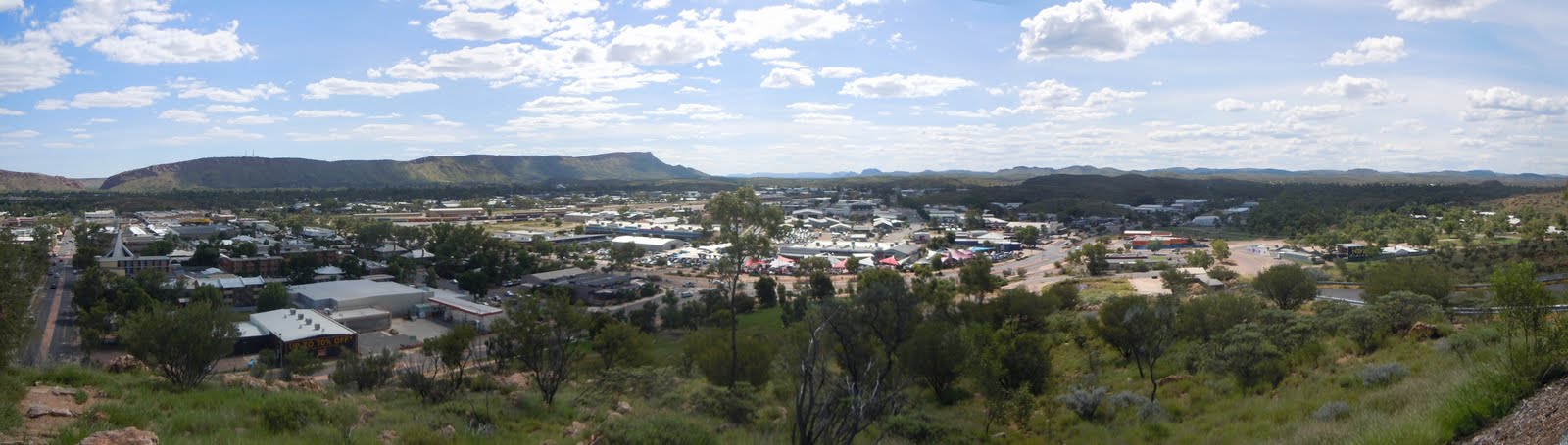
We walked around Alice Springs a bit. Isabella remarked how much smaller it was than she thought it would be. Isabella thought Alice Springs to be a proper city of 100 000+ souls, not the sort of large dusty town of about 20 000 it is. We wandered around the city center and looked at the parks and the dry bed of the Todd River. We also took a drive to the top of ANZAC Hill, which offered a great view of Alice Springs. I have to say, though, that Isabella also encountered her first taste of a less savoury side of Australia --- the relationship between aboriginal and non-aboriginal Australians.

I think that Alice Springs is the strangest city in Australia. If you ever want to see what post-apartheid South Africa looked like, I imagine that Alice Springs is pretty close. The dynamic in that city is so unusual. If you should keep in mind one thing, it is that the relationship between aboriginal and non-aboriginal Australians is very complex and founded on decades of mistrust. There are constant attempts to normalize relations between the 2 groups with some success but Alice Springs seems to be a world apart. What strikes non-locals the most, especially foreigners, is that aboriginals and non-aboriginals do not mix; they seem to be invisible to each other. It's almost as if they exist on 2 different worlds and never the twain shall meet. The aboriginals keep to themselves and talk amongst themselves, all the while ignoring the non-aboriginals; the non-aboriginals do likewise. In all the cities of Australia I've been to, none has this dichotomy on such a scale. I can't imagine a stranger form of existence.

Isabella and I decided to visit the School of the Air. This is an educational institution that provides learning to children in remote communities and stations, as well as the children of itinerant station hands. Its catchment is several thousand square kilometers but it has barely 100 pupils. Originally, the School of the Air was a radio service but in recent years it is mostly run online and beamed via satellite to pupils' homes. The lessons are contained in packs that the parents buy, or are subsidized, and the children complete the lessons and send them back for evaluation. This is under the supervision of a nanny or the parents. In the School of the Air there were examples of student projects and they were all basically the same sort of thing you'd find anywhere else --- model solar systems, model bridges, paintings, etc. Once they reach high school age, the children are sent to boarding schools as the School of the Air doesn't go beyond a certain grade. I think Isabella and I agreed that the enjoyment factor of our education would have been greatly enhanced had we been students of the School of the Air.

From the School of the Air, Isabella and I took a walk around the old telegraph station. This is where Alice Springs was born and it lies right beside the original Alice spring. This watering hole is actually not a spring but part of the Todd River's water table. John Stuart, the first recorded European explorer through these parts, happened upon this water and named it Alice Springs, after Alice Todd, the wife of his boss. Stuart was blazing a trail for a telegraph line to connect Adelaide to Darwin and, by extension, the rest of Australia to the rest of the world. The town that grew up was originally called Stuart until the 1930s when it was renamed Alice Springs. Isabella and I hiked a bit in the hot sun before we met up with our hosts.

Our hosts were 3 radiographers at the local hospital and were very gracious hosts. One of them, Yuk, took us out that evening to explore Alice Springs' many pubs. Jo, the girlfriend of Chris, the other host, did a very motherly thing and told us to call her if we got in trouble. Nothing happened to us that night, although we did see some rambunctiousness. We were sitting at a table in one of the pubs when all of a sudden a scuffle broke out. It wasn't long before those involved were ejected and took their grievance to the street. Luckily it didn't escalate into something more serious but Isabella and I were told that this happens regularly. Oh well, just another part of the rough and tumble of life in the outback.

Despite this, our hosts assured us that they had something special planned for us the next day, something that not many tourists get to see.


Thursday, May 19, 2011

The Greatest Journey -- Rockets and Opals

Unless you've driven on it, it's hard to describe the loneliness of the Stuart Highway. Even though it's the main road to Australia's tropical north and the only paved road that runs the full length, it is still quite a desolate drive. Even though we weren't really that far from civilization, there was hardly any traffic on the road. A few cars here and there but several road trains, the behemoths of the road, the juggernauts of the highways.

Road trains are an Australian innovation and were created to solve the problem of getting supplies to remote communities. They are primarily used to move livestock and fuel but can sometimes take other items. It was realized that it would be more economical to move these things en masse rather than in regular big rigs, so a sort of super big rig was invented. Imagine a big rig with three trailers attached to it, and that's pretty much a road train. But I saw something that I had never seen before, and I've only since seen them in South Australia --- 4-car road trains! I thought that 3 cars was the most you could have but there were some fuel road trains that indeed had 4. Imagine the power necessary to move that much weight. Unfortunately, and this will most disappoint my brother, I don't have a picture.

Isabella and I continued up the Stuart Highway at a fairly brisk speed. In this environment you can see to the far horizon and there are no police patrols, so you can really make some fantastic distances in great time. We were truly in the outback now and the thing about being an outback tourist is that in order to drive from one place of interest to the next, you need a lot of time. The drive to Coober Pedy would be long but there was one place to stop along the way, Woomera.

Woomera was built after World War 2 as a military community to support Australia's Cold War communications roles and as a base for Australia's space program. The community was built just off the Stuart Highway and for a long time was a closed community, though there is free access now. Woomera became the home of Australia's space program and from there Australia launched its first satellites, the 3rd country to do so from its own soil. Appropriately, a "woomera" is an aboriginal device which cradled a spear. Rockets were launched from Woomera for many decades before the program was shut down.

Isabella and I pulled in to Woomera and felt that we had stumbled across a town that had seen much better days. We stopped to get some produce from the local store but the shelves were mostly empty, as were the streets. Woomera seemed almost a ghost town. The town's main attraction is the Missile Park which has examples of Australian rocketry and assorted military paraphernalia. We sort of wandered around before driving the streets, many of which once had buildings beside them, but now were just through empty lots. The town wasn't very exciting or interesting, I'm afraid, so we left pretty quickly.

As we drove out of Woomera we entered the Woomera Prohibited Area. To support the military operations at Woomera, the Commonwealth declared that a very large area of South Australia would henceforth be prohibited from unauthorized entry. Further away, the Australian government had detonated British nuclear weapons on their behalf for testing. You still can't enter the Woomera Prohibited Area without permission except on certain public roads, the Stuart Highway being one of them. Every so often there was a sign on the side of the road reminding you that entry onto the land was prohibited.

Woomera was also in the news a few years ago when a refugee detention centre was built there on the nearby army base. It seemed to me to be such a waste of time and resources to move these asylum seekers halfway across the country into one of its more remote areas. However, politics is all about presentation and this "looked good". The center was eventually shut down due to health concerns.

Isabella and I drove on, watching as the kilometers ticked away and terrain became more flat and even less green. After some time there didn't seem to be any plants at all and it was truly a desert. Something we did see along the way which amused us were a series of signs that warned of camels and livestock on the road in 4 languages: English, German, Mandarin and Japanese. It seems that these 4 groups constitute the bulk of the people that come through this way. One thing we did see, which made us very glad, was blue sky and sunshine for the first time on the trip. We'd finally cleared the rainy patches and were on our way to sunny skies.

After driving what seemed like an eternity, we reached Coober Pedy, the opal capital of Australia. When a track was being blazed through this area, the Europeans found themselves in a bit of a fix as they were running out of water and the temperatures were searing. The leader told his son to mind the camp while they went off. The son didn't listen and when he returned his father was about to admonish him when the son revealed that not only had he found water, he'd also found opals. Now, what can you say to that?

After some time, news of this find spread and eventually others followed and set up individual mining operations. The local aboriginals came to call the area "kupa piti" which literally translates as "the uninitiated peoples' hole in the ground", but the sense is "white man's hole", and this became anglicized to Coober Pedy. This is because digging for opals requires deep holes to be dug. There were even signs to be careful as there were open shafts in the area. Because it's so risky, opal mining is an entirely private enterprise and there are no opal mining corporations as such, at least not in Coober Pedy.

Opal mining still happens in Coober Pedy and to help this, a local invented something called a "blower", which is just a truck with a big fan. As the rock is crushed up, the blower sucks up the rock and then blows it out the other end. The miner can then separate the poor quality opal, or "potch", from the fine quality. There's a giant blower on a sign as you drive in to Coober Pedy.

Another of Coober Pedy's innovations was the underground dwelling. These dwellings aren't really underground but built into the hills. In the days before air conditioning, this was the way to keep your property cool. The ground is an excellent insulator and the homes are fine all year round. Unfortunately all the land for this purpose has been used up so the only way you'll get such a dwelling is if you buy one, but what a wonderful existence. It's not only dwellings that are made this way, but a few churches as well. The most famous one is the Serbian church but as they charge admission, Isabella and I went to the free Catacombs Church. It was certainly much cooler inside than outside but it did smell a bit funny.

You'll have noticed that I just mentioned that there is a Serbian church. In case you think that Coober Pedy is some sort of backwards backwater, it most definitely is not. The town prides itself on its cosmopolitanism and states in the public literature that there are some 40 ethnicities in Coober Pedy; this for a population of 2 000. So Coober Pedy is a bit of a melting pot as well, and melt you might, given the local heat.

And the amazing things about Coober Pedy don't stop there. The city is not on the state's power grid and produces all of its power locally from generators, wind power and solar power. It's also been the scene of science fiction movies, like Pitch Black, lies close to the Dingo Fence (I'll write about that later), is the last truly populated place on the Stuart Highway until Alice Springs, some 500+ kilometers to the north and, in keeping with the Australian penchant for "big" things, had the Big Winch. Coober Pedy is a truly remarkable, if remote, place.

Isabella and I decided to rough it a bit and checked into a caravan park but we got a metered site; not too rough, now. We originally wanted to stay in an underground hostel but when we got there, even though there was a sign saying they'd reopen in January, it appeared closed. We were a little disappointed but liked the place we picked anyway.

Later on we went for a tour in the Opal Museum, which is mostly underground. We saw the history of the town, how opal is formed and even went through an old mine. There is even an example of an underground home. When we got to the bedroom someone on the tour made perhaps the worst joke I'd ever heard; he said, "No jokes now about making the bed rock." You cannot imagine the groans that little bit of humour received. I still think it was the highlight of the tour. To finish it off, the tour guide even showed us how opal is polished.

After some more wandering around the town, Isabella and I got some pizzas for dinner and watched an Australia classic, The Castle. It's about a family fighting a large corporation trying to expropriate their home to expand the airport. It's a comedy and I it's one of my favourite Australian movies. With the sun setting on the featureless horizon, Isabella and I fell asleep wondering how the next day would turn out. We would finally be stopping some place for a few days and we were heading to Australia's most famous outback city --- Alice Springs.


Tuesday, May 17, 2011

The Greatest Journey -- Stations and Crossroads

In the morning we were given a really special treat, a visit to Rupee Station. Rupee Station is where Isabella and I were to have spent the night but because of the raging creek we were prevented. It's only about 15 kilometers outside Broken Hill and owned by Corey's girlfriend's dad, who is a famous environmental lawyer apparently.

Isabella and I climbed into Corey's 4WD and he drove us out to the station, past a locked gate, the now dry creek bed and a set of railway tracks. The morning was cloudy but broken clouds and I had seen on the Bureau of Meteorology website that no further rain was forecast and the trough causing it had stalled, meaning we were in for fine weather finally. On arriving at the house, Isabella and I received a tour of the property, or station as they are known in Australia.

As far as stations go, this one is not very big but that doesn't mean much when stations can be several thousand hectares and be considered average. The largest, Anna Creek in South Australia, is the size of Belgium! The first thing Isabella and I did was bottle feed some 2 or 3 day old lambs; the owner said Isabella was a natural. I found it really fun except when the lambs got a bit fidgety. Walking around the property we saw the remnants of its mining days which consisted of rusted implements like shovels and tea pots. There was a shearing shed complete with a herd of sheep, there was a ram with an especially forceful personality, some cows, a few horses, some chickens and 2 dogs. It was very much a typical Australian sheep station. We were there only about 2 hours but Isabella and I had a great time. If I'm ever back that way I'm definitely going out for a visit.

After parting with Corey, Isabella and I were on the next leg of our journey. We stopped in a shop that sold silver and Isabella bought herself another pair of earrings. From there, it was back on to the Barrier Highway and into South Australia.

Our destination was a little rest stop north of Port Augusta. Not far from Broken Hill we reached the state border at Cockburn which wasn't much more than a gas station and a restaurant. The next place wee stopped was called Olary and it even though it was almost nowhere, it did have a train station, of sorts. Isabella and I had picked up some supplies but we read signs that there was a quarantine inspection station no too far within South Australia so we had some lunch at Olary before continuing on. As far as I know, Australia is the only country in the world that has quarantine zones within its borders.

Although the Barrier Highway is the main road into South Australia from NSW there wasn't much traffic to speak of. I guess because it was summer and the highway is pretty remote anyway. I remember pulling to the side of the road to finish off a salad just before the inspection station and when I went to restart the motor, it wouldn't go. I tried a few more times and nothing. As Isabella and I sat there wondering what was going on and how would we get help on this lonely stretch of road, I suddenly realized that I had left the car in drive. On a hunch, I put it in park and then turned the key --- the engine came to life. I can't tell you how relieve we both were.

After a little more driving we reached the head of the Spencer Gulf, the location of Port Augusta. Port Augusta is only a small city but quite an important one. Firstly, it supplies much of South Australia's power via some very large power stations. Why they put them there, I don't know. Secondly, Port Augusta is at the crossroads of Australia and this is how it advertises itself. All the major north-south and east-west road and rail links across Australia join at Port Augusta. It's also, as the name suggests, a port town and is home to a fishing fleet. Unfortunately our first introduction to Port Augusta wasn't that impressive as the coastal marshes really smelled terrible as we drove in. And, for the record, this is another place which is the hometown of one of my many Australian acquaintances, Sam. Isabella and I didn't stay in Port Augusta and we continued driving north on the Stuart Highway. About 60 kilometers north of the city, we reached our destination.

The weather had finally cleared up and Isabella and I were anxious for some more camping. We parked in a highway rest top zone under a big metal roof. There were some information panels that gave the history of the region. Isabella took out her gas cooker and we both sat down to a well-cooked pasta meal. We also saw the sun set with brilliant hues of red, orange and purple. We were finally glad to be rid of the rain and looking forward to the next few days which would take us into the very heart of the continent.