Wednesday, May 25, 2011

The Greatest Journey -- Gorgeous Gorges

Our hosts were the adventurous type so they planned to take us on a hike through Redbank Gorge, a large cleft in the rock about 150 kilometers west of Alice Springs. In addition to us, a few of our hosts' friends would also be joining this little excursion. We left Alice Springs in the morning and had lunch at the entrance to Redbank Gorge. I remember it being a hot day, although there really is no other kind in this part of Australia, and after lunch we were all eager to get into the cool waters of the stream that ran through the gorge.

Redbank Gorge is actually the furthest in a series of gorges that run west from Alice Springs in the West MacDonnell Range. To get there you have to take Larapinta Drive west out of Alice Springs and just keep going. In fact, this is also the way to Hermannsburg, an aboriginal settlement even further west. As it is the furthest of the gorges, not many tourists get to it which is always a little fun. I guess because humans are explorers by nature we feel a sense of strange satisfaction if we come across something few others see. Somehow, we feel better about the experience.

Anyway, we all walked from the parking lot to Redbank Gorge's beginning. We changed into our swimsuits and had to run across the hot sand to make it to the water. That's how you get through the gorge; you have to swim for while before walking or grappling up to the next place. Think of it like a series of locks on a canal.

We swam for a while before we met our first obstacle, a rock face with a log that we had to climb to get to the next level. It wasn't an easy climb and I dreaded how we would get back down when returning. The next thing we noticed were these incredibly large yellow spider webs with what seemed like massive spiders in the center. They went all the way up the rock wall to the top of the gorge. This seemed somewhat disconcerting, that there could be vicious spiders lurking just above us. I said that I finally understood why it was called Redbank Gorge. If they'd tried Colossal Deadly Spider Gorge, the tourists simply wouldn't come.

We pressed on and continued to swim along the stream. There were a few more places where we had to climb up but eventually we reached a sheer rock wall that we couldn't pass. This wasn't the end of the gorge but it was pretty close and we all felt a sense of accomplishment. We turned around and started to swim back. Along the way, Isabella became terrified of an object in the water she was sure was a snake. Now, if it was a snake, this would be problematic as many snakes are venomous. Luckily it turned out to be a perentie, a large lizard. We made it out of the gorge without further incident and eventually got back to the car.

Our hosts and their friends wanted to check out another place further away but the road was only suitable for 4WD vehicles so Isabella and I decided that we would drive back to Alice Springs. Along the way we would visit some of the other gorges we had passed. The first one was Helen Gorge which has a much larger body of water in it so we just admired it from afar. We next stopped at Ormiston Gorge where we took a hike up to a viewing platform. Our last stop was the Ochre Pits where aboriginal people used to get ochre from. The ochre was used as paint for various reasons. If I recall correctly, this ochre has been found in ancient sites as far away as Western Australia and Queensland. Clearly, aboriginal people had long trade routes across the country centuries before Europeans arrived. At this point, the sun was starting to set so Isabella and I set off for Alice Springs.

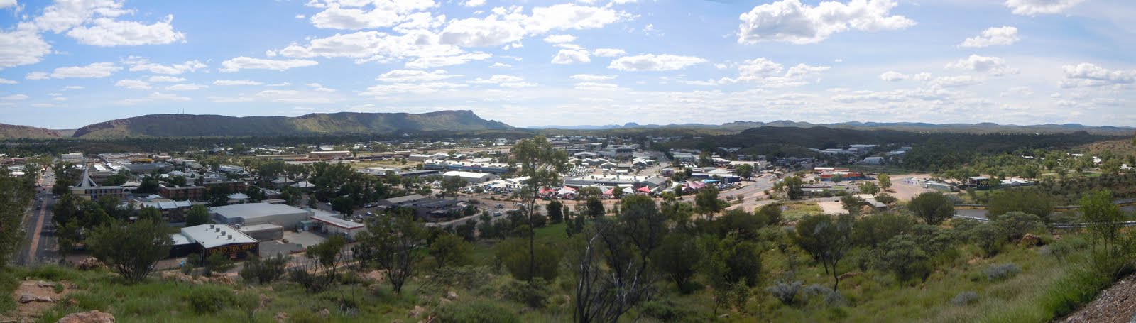
On the way back we had an encounter that I think was very poignant and telling. About 26 kilometers out of Alice Springs, Isabella and I noticed a car on the side of the road. We stopped and noticed that it was an aboriginal family of about 6 or 7 people. We asked them if they needed help and it turned out that they'd run out of gas. We offered to take some of them into town to buy some gas and then return them to the car. Isabella cleared the back seats and 2 women and a young boy jumped in. They didn't speak much although we did talk about this and that. It turns out they were a family from Hermannsburg going to Alice Springs to visit relatives. When we got to Alice Springs I dropped Isabella off at Coles, a local supermarket, and then drove my aboriginal passengers to a BP service station. There they filled up on gas in a jerry, got 1 or 2 food items and then we got back in the car. As I drove back they told me something that has stuck with me. They said that they'd been waiting for 2 hours and no one had stopped to help them! I could scarcely believe my ears. Larapinta Drive is by no means a well-travelled road but there are cars occasionally. I couldn't believe that no one had stopped. I dropped my travellers off at their car and then drove back to Alice Springs with a sense of disbelief.

Anwyay, that night Isabella and I had agreed to treat our hosts to a Canadian dish as a thank you for their hospitality. We made them poutine, that quintessentially unhealthy Canadian dish. In return, our hosts had prepared a dinner of kangaroo meat, so it was stereotypes all around. Chris, Jo and Yuk said they liked the poutine and I can assure you that the kangaroo meat was first class too.

Our last day in Alice Springs would be spent in the city, but at a very interesting place. As much as I like to travel, I knew that the constant movement was beginning to take its toll on Isabella, and myself, I suppose. It felt good to be able to stay in one place for a few days and really get to know it, and its people, the good, the bad and the ugly.


Tuesday, May 24, 2011

The Greatest Journey -- The Green Red Centre

The very heart of Australia is colloquially known as the Red Centre, so named because of the red earth everywhere. It's a baking expanse of semi-arid land the few could survive unassisted. It was here that Isabella and I travelled to next.

We set off fairly early in the morning from Coober Pedy. The beauty of the Stuart Highway, though, is that there is so little traffic that you can really let yourself fly. It was 700 kilometers from Coober Pedy to Alice Springs and I was determined to see how fast we could get there. After all, it's not like there's anything in between, really.

Driving out of Coober Pedy the land remained rocky and bare, a true desert. Kilometer after featureless kilometer clicked away as we sped north. However, slowly but surely, the landscape began to change. Here and there shrubs began to appear, later whole clumps and by the time we hit the Northern Territory border, full trees. That summer, with the brilliant end to the Australian drought, the Red Centre had been transformed into the Green Centre. Everywhere there seemed to be an abundance of plant life. The last time I was in the area, in 2005, the ground was much more bare, though perhaps not as bare as I remembered. Still, to see Australia's interior so wonderfully green was quite the treat.

The border with the Northern Territory wasn't much more than a rest stop so we continued on, refuelling at a roadhouse called Kulgera. Onward we drove until finally the traffic picked up a bit and we could see many cars and trucks in the distance. We drove through Heavitree Gap, a pass in the hills, and drove into Alice Springs. We'd covered the 700 kilometers in less than 5 hours. We had plenty of time to explore the city before we were to meet up with our couchsurf hosts. It would also be a chance for us to rest as we'd been on the move, more or less continuously for about a week. That is the unfortunate consequence of changed plans.

We walked around Alice Springs a bit. Isabella remarked how much smaller it was than she thought it would be. Isabella thought Alice Springs to be a proper city of 100 000+ souls, not the sort of large dusty town of about 20 000 it is. We wandered around the city center and looked at the parks and the dry bed of the Todd River. We also took a drive to the top of ANZAC Hill, which offered a great view of Alice Springs. I have to say, though, that Isabella also encountered her first taste of a less savoury side of Australia --- the relationship between aboriginal and non-aboriginal Australians.

I think that Alice Springs is the strangest city in Australia. If you ever want to see what post-apartheid South Africa looked like, I imagine that Alice Springs is pretty close. The dynamic in that city is so unusual. If you should keep in mind one thing, it is that the relationship between aboriginal and non-aboriginal Australians is very complex and founded on decades of mistrust. There are constant attempts to normalize relations between the 2 groups with some success but Alice Springs seems to be a world apart. What strikes non-locals the most, especially foreigners, is that aboriginals and non-aboriginals do not mix; they seem to be invisible to each other. It's almost as if they exist on 2 different worlds and never the twain shall meet. The aboriginals keep to themselves and talk amongst themselves, all the while ignoring the non-aboriginals; the non-aboriginals do likewise. In all the cities of Australia I've been to, none has this dichotomy on such a scale. I can't imagine a stranger form of existence.

Isabella and I decided to visit the School of the Air. This is an educational institution that provides learning to children in remote communities and stations, as well as the children of itinerant station hands. Its catchment is several thousand square kilometers but it has barely 100 pupils. Originally, the School of the Air was a radio service but in recent years it is mostly run online and beamed via satellite to pupils' homes. The lessons are contained in packs that the parents buy, or are subsidized, and the children complete the lessons and send them back for evaluation. This is under the supervision of a nanny or the parents. In the School of the Air there were examples of student projects and they were all basically the same sort of thing you'd find anywhere else --- model solar systems, model bridges, paintings, etc. Once they reach high school age, the children are sent to boarding schools as the School of the Air doesn't go beyond a certain grade. I think Isabella and I agreed that the enjoyment factor of our education would have been greatly enhanced had we been students of the School of the Air.

From the School of the Air, Isabella and I took a walk around the old telegraph station. This is where Alice Springs was born and it lies right beside the original Alice spring. This watering hole is actually not a spring but part of the Todd River's water table. John Stuart, the first recorded European explorer through these parts, happened upon this water and named it Alice Springs, after Alice Todd, the wife of his boss. Stuart was blazing a trail for a telegraph line to connect Adelaide to Darwin and, by extension, the rest of Australia to the rest of the world. The town that grew up was originally called Stuart until the 1930s when it was renamed Alice Springs. Isabella and I hiked a bit in the hot sun before we met up with our hosts.

Our hosts were 3 radiographers at the local hospital and were very gracious hosts. One of them, Yuk, took us out that evening to explore Alice Springs' many pubs. Jo, the girlfriend of Chris, the other host, did a very motherly thing and told us to call her if we got in trouble. Nothing happened to us that night, although we did see some rambunctiousness. We were sitting at a table in one of the pubs when all of a sudden a scuffle broke out. It wasn't long before those involved were ejected and took their grievance to the street. Luckily it didn't escalate into something more serious but Isabella and I were told that this happens regularly. Oh well, just another part of the rough and tumble of life in the outback.

Despite this, our hosts assured us that they had something special planned for us the next day, something that not many tourists get to see.


Thursday, May 19, 2011

The Greatest Journey -- Rockets and Opals

Unless you've driven on it, it's hard to describe the loneliness of the Stuart Highway. Even though it's the main road to Australia's tropical north and the only paved road that runs the full length, it is still quite a desolate drive. Even though we weren't really that far from civilization, there was hardly any traffic on the road. A few cars here and there but several road trains, the behemoths of the road, the juggernauts of the highways.

Road trains are an Australian innovation and were created to solve the problem of getting supplies to remote communities. They are primarily used to move livestock and fuel but can sometimes take other items. It was realized that it would be more economical to move these things en masse rather than in regular big rigs, so a sort of super big rig was invented. Imagine a big rig with three trailers attached to it, and that's pretty much a road train. But I saw something that I had never seen before, and I've only since seen them in South Australia --- 4-car road trains! I thought that 3 cars was the most you could have but there were some fuel road trains that indeed had 4. Imagine the power necessary to move that much weight. Unfortunately, and this will most disappoint my brother, I don't have a picture.

Isabella and I continued up the Stuart Highway at a fairly brisk speed. In this environment you can see to the far horizon and there are no police patrols, so you can really make some fantastic distances in great time. We were truly in the outback now and the thing about being an outback tourist is that in order to drive from one place of interest to the next, you need a lot of time. The drive to Coober Pedy would be long but there was one place to stop along the way, Woomera.

Woomera was built after World War 2 as a military community to support Australia's Cold War communications roles and as a base for Australia's space program. The community was built just off the Stuart Highway and for a long time was a closed community, though there is free access now. Woomera became the home of Australia's space program and from there Australia launched its first satellites, the 3rd country to do so from its own soil. Appropriately, a "woomera" is an aboriginal device which cradled a spear. Rockets were launched from Woomera for many decades before the program was shut down.

Isabella and I pulled in to Woomera and felt that we had stumbled across a town that had seen much better days. We stopped to get some produce from the local store but the shelves were mostly empty, as were the streets. Woomera seemed almost a ghost town. The town's main attraction is the Missile Park which has examples of Australian rocketry and assorted military paraphernalia. We sort of wandered around before driving the streets, many of which once had buildings beside them, but now were just through empty lots. The town wasn't very exciting or interesting, I'm afraid, so we left pretty quickly.

As we drove out of Woomera we entered the Woomera Prohibited Area. To support the military operations at Woomera, the Commonwealth declared that a very large area of South Australia would henceforth be prohibited from unauthorized entry. Further away, the Australian government had detonated British nuclear weapons on their behalf for testing. You still can't enter the Woomera Prohibited Area without permission except on certain public roads, the Stuart Highway being one of them. Every so often there was a sign on the side of the road reminding you that entry onto the land was prohibited.

Woomera was also in the news a few years ago when a refugee detention centre was built there on the nearby army base. It seemed to me to be such a waste of time and resources to move these asylum seekers halfway across the country into one of its more remote areas. However, politics is all about presentation and this "looked good". The center was eventually shut down due to health concerns.

Isabella and I drove on, watching as the kilometers ticked away and terrain became more flat and even less green. After some time there didn't seem to be any plants at all and it was truly a desert. Something we did see along the way which amused us were a series of signs that warned of camels and livestock on the road in 4 languages: English, German, Mandarin and Japanese. It seems that these 4 groups constitute the bulk of the people that come through this way. One thing we did see, which made us very glad, was blue sky and sunshine for the first time on the trip. We'd finally cleared the rainy patches and were on our way to sunny skies.

After driving what seemed like an eternity, we reached Coober Pedy, the opal capital of Australia. When a track was being blazed through this area, the Europeans found themselves in a bit of a fix as they were running out of water and the temperatures were searing. The leader told his son to mind the camp while they went off. The son didn't listen and when he returned his father was about to admonish him when the son revealed that not only had he found water, he'd also found opals. Now, what can you say to that?

After some time, news of this find spread and eventually others followed and set up individual mining operations. The local aboriginals came to call the area "kupa piti" which literally translates as "the uninitiated peoples' hole in the ground", but the sense is "white man's hole", and this became anglicized to Coober Pedy. This is because digging for opals requires deep holes to be dug. There were even signs to be careful as there were open shafts in the area. Because it's so risky, opal mining is an entirely private enterprise and there are no opal mining corporations as such, at least not in Coober Pedy.

Opal mining still happens in Coober Pedy and to help this, a local invented something called a "blower", which is just a truck with a big fan. As the rock is crushed up, the blower sucks up the rock and then blows it out the other end. The miner can then separate the poor quality opal, or "potch", from the fine quality. There's a giant blower on a sign as you drive in to Coober Pedy.

Another of Coober Pedy's innovations was the underground dwelling. These dwellings aren't really underground but built into the hills. In the days before air conditioning, this was the way to keep your property cool. The ground is an excellent insulator and the homes are fine all year round. Unfortunately all the land for this purpose has been used up so the only way you'll get such a dwelling is if you buy one, but what a wonderful existence. It's not only dwellings that are made this way, but a few churches as well. The most famous one is the Serbian church but as they charge admission, Isabella and I went to the free Catacombs Church. It was certainly much cooler inside than outside but it did smell a bit funny.

You'll have noticed that I just mentioned that there is a Serbian church. In case you think that Coober Pedy is some sort of backwards backwater, it most definitely is not. The town prides itself on its cosmopolitanism and states in the public literature that there are some 40 ethnicities in Coober Pedy; this for a population of 2 000. So Coober Pedy is a bit of a melting pot as well, and melt you might, given the local heat.

And the amazing things about Coober Pedy don't stop there. The city is not on the state's power grid and produces all of its power locally from generators, wind power and solar power. It's also been the scene of science fiction movies, like Pitch Black, lies close to the Dingo Fence (I'll write about that later), is the last truly populated place on the Stuart Highway until Alice Springs, some 500+ kilometers to the north and, in keeping with the Australian penchant for "big" things, had the Big Winch. Coober Pedy is a truly remarkable, if remote, place.

Isabella and I decided to rough it a bit and checked into a caravan park but we got a metered site; not too rough, now. We originally wanted to stay in an underground hostel but when we got there, even though there was a sign saying they'd reopen in January, it appeared closed. We were a little disappointed but liked the place we picked anyway.

Later on we went for a tour in the Opal Museum, which is mostly underground. We saw the history of the town, how opal is formed and even went through an old mine. There is even an example of an underground home. When we got to the bedroom someone on the tour made perhaps the worst joke I'd ever heard; he said, "No jokes now about making the bed rock." You cannot imagine the groans that little bit of humour received. I still think it was the highlight of the tour. To finish it off, the tour guide even showed us how opal is polished.

After some more wandering around the town, Isabella and I got some pizzas for dinner and watched an Australia classic, The Castle. It's about a family fighting a large corporation trying to expropriate their home to expand the airport. It's a comedy and I it's one of my favourite Australian movies. With the sun setting on the featureless horizon, Isabella and I fell asleep wondering how the next day would turn out. We would finally be stopping some place for a few days and we were heading to Australia's most famous outback city --- Alice Springs.


Tuesday, May 17, 2011

The Greatest Journey -- Stations and Crossroads

In the morning we were given a really special treat, a visit to Rupee Station. Rupee Station is where Isabella and I were to have spent the night but because of the raging creek we were prevented. It's only about 15 kilometers outside Broken Hill and owned by Corey's girlfriend's dad, who is a famous environmental lawyer apparently.

Isabella and I climbed into Corey's 4WD and he drove us out to the station, past a locked gate, the now dry creek bed and a set of railway tracks. The morning was cloudy but broken clouds and I had seen on the Bureau of Meteorology website that no further rain was forecast and the trough causing it had stalled, meaning we were in for fine weather finally. On arriving at the house, Isabella and I received a tour of the property, or station as they are known in Australia.

As far as stations go, this one is not very big but that doesn't mean much when stations can be several thousand hectares and be considered average. The largest, Anna Creek in South Australia, is the size of Belgium! The first thing Isabella and I did was bottle feed some 2 or 3 day old lambs; the owner said Isabella was a natural. I found it really fun except when the lambs got a bit fidgety. Walking around the property we saw the remnants of its mining days which consisted of rusted implements like shovels and tea pots. There was a shearing shed complete with a herd of sheep, there was a ram with an especially forceful personality, some cows, a few horses, some chickens and 2 dogs. It was very much a typical Australian sheep station. We were there only about 2 hours but Isabella and I had a great time. If I'm ever back that way I'm definitely going out for a visit.

After parting with Corey, Isabella and I were on the next leg of our journey. We stopped in a shop that sold silver and Isabella bought herself another pair of earrings. From there, it was back on to the Barrier Highway and into South Australia.

Our destination was a little rest stop north of Port Augusta. Not far from Broken Hill we reached the state border at Cockburn which wasn't much more than a gas station and a restaurant. The next place wee stopped was called Olary and it even though it was almost nowhere, it did have a train station, of sorts. Isabella and I had picked up some supplies but we read signs that there was a quarantine inspection station no too far within South Australia so we had some lunch at Olary before continuing on. As far as I know, Australia is the only country in the world that has quarantine zones within its borders.

Although the Barrier Highway is the main road into South Australia from NSW there wasn't much traffic to speak of. I guess because it was summer and the highway is pretty remote anyway. I remember pulling to the side of the road to finish off a salad just before the inspection station and when I went to restart the motor, it wouldn't go. I tried a few more times and nothing. As Isabella and I sat there wondering what was going on and how would we get help on this lonely stretch of road, I suddenly realized that I had left the car in drive. On a hunch, I put it in park and then turned the key --- the engine came to life. I can't tell you how relieve we both were.

After a little more driving we reached the head of the Spencer Gulf, the location of Port Augusta. Port Augusta is only a small city but quite an important one. Firstly, it supplies much of South Australia's power via some very large power stations. Why they put them there, I don't know. Secondly, Port Augusta is at the crossroads of Australia and this is how it advertises itself. All the major north-south and east-west road and rail links across Australia join at Port Augusta. It's also, as the name suggests, a port town and is home to a fishing fleet. Unfortunately our first introduction to Port Augusta wasn't that impressive as the coastal marshes really smelled terrible as we drove in. And, for the record, this is another place which is the hometown of one of my many Australian acquaintances, Sam. Isabella and I didn't stay in Port Augusta and we continued driving north on the Stuart Highway. About 60 kilometers north of the city, we reached our destination.

The weather had finally cleared up and Isabella and I were anxious for some more camping. We parked in a highway rest top zone under a big metal roof. There were some information panels that gave the history of the region. Isabella took out her gas cooker and we both sat down to a well-cooked pasta meal. We also saw the sun set with brilliant hues of red, orange and purple. We were finally glad to be rid of the rain and looking forward to the next few days which would take us into the very heart of the continent.


Monday, May 16, 2011

The Greatest Journey -- Broken Hill

Much to our chagrin, the trough that had been chasing us west caught up to us overnight and it was a very rainy morning in Cobar. Now rain is a rare event in this town and even more unusual in the summer. Australia suffers from weather extremes --- punishing drought and fierce deluges. Australia had just spectacularly ended its decade-long drought and so much of the country was now finding itself under rain. Isabella and I hoped that the rain wouldn't dampen our spirits as we headed further west down the Barrier Highway.

As we drove out of Cobar, the few trees there were eventually gave way to a flat treeless plain, much like the prairies of Canada, only much less verdant. From our car to the far horizon was nothing but blue sky, arid land and telephone wires. The only place of note between Cobar and Broken Hill is Wilcannia which looks so run down that we didn't even stop. It was a fairly featureless 460 kilometers to Broken Hill, and yet we both thought it was spectacular in its own way.

Just before making it to Broken Hill we saw signs for something called the Fruit Fly Exclusion Zone. To guard the fragile outback orchards there is a zone through which no outside fruit or vegetable matter can pass. We had bought some fruit earlier in our trip but we finished it before we reached the exclusion zone. Just before Broken Hill there is a little turn-off with a garbage can to place your fruit and vegetables in. I thought it was kind of quaint.

Broken Hill is the largest center in far western NSW with a population of about 20 000. It used to be more but as mining has declined in importance, so has its population. Broken Hill made its fortune in silver and copper mining, but especially silver but now the mines aren't producing as much. It's still an important outback center and one of the iconic cities of Australia.

We drove into Broken Hill in the early afternoon but our couchsurf host was still at work so Isabella and I had to decide on an activity. Unfortunately the rain hadn't really let up so we would have to do something indoors. We settled on going to the Royal Flying Doctor Service base at the airport.

The RFDS was set up by Dr. John Flynn as a way of bringing medical aid to remote places and it is exactly what it sounds like --- a group of doctors who are flown around. The planes are modified to carry patients and medical equipment. Each remote station is required to maintain a basic airstrip so that the planes can land if need be. Patients can be flown to Broken Hill for treatment or if something more specialized is required, to Adelaide, which reminds me of another of Broken Hill's peculiarities.

Broken Hill is only 50 kilometers east of the border with South Australia and in many ways identifies with it. I once read that many years ago the NSW government in Sydney wanted to reduce services in Broken Hill since it was "just a pinpoint on a map." This necessarily angered the residents of Broken Hill as their mining industry was responsible for much of the state's wealth. They declared that from their point of view Sydney was also just a pinpoint on a map and they would henceforth join South Australia. The federal government stepped in and said that while Broken Hill could adopt South Australian time, the South Australian area code and Aussie rules football as the premier sport of the area (as indeed it has), it could not secede from NSW. So now Broken Hill is a bit of an anomaly in western NSW and therein lies its appeal.

Anyway, Isabella and I wandered around the RFDS HQ which includes a museum about the RFDS. A little later we went on a tour of the facilities and saw the control room as well as the hangar. It's still mostly run on radio from the outstations but in the early days electricity was a scarce luxury in the outback. To combat this a Dr. Traeger devised a radio that could work by pedalling meaning it could be used at any time by anyone. I saw a model and thought how ingenious the design was. The hangar was quite impressive too but what worried us was the sudden tremendous deluge that came down. We had to meet our couchsurf host and before we left, Isabella bought a pair of silver earrings at the gift shop to support the RFDS.

Our couchsurf host, Corey, had given us the address of his parents' place in town. As we drove out of the airport towards their home we came across a traffic circle that seemed a series of rapids. The water was fast-flowing and we were wondering how to get across as this was the only way into town from the airport. We saw a car make it across and so, crossing our fingers, I gunned the engine and drove straight into the raging river. Luckily it wasn't deep and we made it across without any further problems. We found our way to the house where we were warmly greeted by Corey's family.

The original plan was for myself and Isabella to stay with Corey's girlfriend's father out at his sheep station outside of town. However, the rain had created a raging creek across the entrance to the property with a depth greater than the hood of a 4WD vehicle. So, with that option gone Isabella and I stayed at Corey's parents' place in town. I got Corey's room while Isabella slept in his sister's room and this is where things got a little ironic. Even though the experience is called couchsurfing, in this case Corey had kicked himself out of his own room and was sleeping on the couch himself while I got to sleep in his bed!

That evening, Corey and his friends took Isabella and myself out on the town. The first place we drove to was a large park bench with a nice view of Broken Hill. The second place we stopped was a cocktail lounge, although we later visited a pub. Broken Hill prides itself on being the Australian city with the highest per capita rate of pubs, so you think it should be a rough and tumble city, and perhaps it once was. However, the cocktail lounge we were sitting in was quite pleasant and had a very urban feel to it; I guess it shows that even the outback is becoming more sophisticated and yuppied.

Finally, Isabella and I had a special treat that night as Corey and his father both work for the local newspaper and we were shown around the offices. Later they ran the presses and we got to see how such a production works, which I found fascinating. The cars used to deliver the newspapers even had slingshots on them so that the deliverers could just launch them out of the car!

Even though we only had a short time in Broken Hill, Isabella and I found it enlightening and entertaining. I hope I get a chance to get back there, this time to get better acquainted with the city. On the happy side, our luck was about to change.


Thursday, May 5, 2011

The Greatest Journey -- Cul de Sac

Isabella and I awoke early in the morning thanks to the overnight rain. While we slept, a weather front had moved in and cause a bit of a downpour. Try as she might, Isabella had not been able to completely waterproof her tent and it was a bit damp when we woke up. Luckily it wasn't too bad and we quickly packed up.

We drove around Moree for a bit before we stopped in at a McDonald's for breakfast. I wasn't hungry but Isabella had a little something. I remember thinking that I quite liked Moree. It seems that it is at the center of a large aquifer region with many farms surrounding it. For some reason there are also hot springs and Moree has been a tourism destination for over 100 years for that reason. Anyway, we didn't linger in Moree and we set off down the Gwydir Highway again, this time westerly. Our destination today was either Bourke or Cobar. Bourke is a famous Australian outback town and lent its name to the expression "Back o' Bourke" meaning a long way away. Bourke was meant to be a sort of trade-off as our destination the next day would be Broken Hill. Going to Bourke would mean a shorter drive today but a longer drive tomorrow than if we drove to Cobar. As we set out, it looked like we would make Bourke before noon.

As we drove we passed several very small towns and sheep stations. One was called Calgary and we got a photo of it as Calgary, Alberta is where Isabella lives. As we continued west the landscape became more prairie-like as the trees started to give way to vast unyielding grassland. We then reached a town called Walgett which was a small hub of activity. It sits on the intersection of 2 highways and we saw the road trains, those gargantuan trucks of the Australian outback, at their various marshalling points.

As we left Walgett on the Kamilaroi Highway I noticed a sign that said "Road Closed Beyond Brewarrina". I took a look at my atlas and discovered that Brewarrina was right on our road to Bourke. I also noticed that there were alternative routes from Brewarrina to Bourke so after some discussion Isabella and I decided to risk it. We drove for about another hour before we reached the town of Brewarrina.

At Brewarrina the highway was indeed closed. I stepped into the local shire council to see what the status of the roads to Bourke was and the news made my heart sink --- they were all closed or virtually impassable. Unless we'd had a 4WD vehicle, most of the roads were completely flooded and it wasn't just a question of waiting for a few hours for the water level to go down; this was fairly extensive. Needless to say, I hadn't expected this. Although I knew that Australia's internal drainage meant that Queensland's flood waters flowed this way I thought we'd have more time. Also, there'd been nothing in the news about floods in NSW. I guess floods are not respecters of political boundaries.

I chatted with a very pleasant fellow employed by the shire to see how we mightn't be able to reach Bourke without having to do a huge detour. We tried every possibility but nothing worked for us. Less than 100km from our destination and we couldn't reach it. It was clear that we'd have to give Bourke a miss so I informed Isabella of the situation and that we'd have to make for Cobar instead. It also meant a very large detour involving a backtrack to Walgett and then going through towns like Warren and Nyngan. It meant that about 400km was added to our journey that day. So much for our plans for a short drive.

Since we were already there and it was approaching lunch time, Isabella and I decided to make the best of it and have a look about the town. We wandered in to the local museum where we saw a short history video of the town. It turns out Brewarrina is the furthest navigable point on the Barwon River and it has the oldest fish traps in Australia. These fish traps were made by Aboriginals many thousands of years ago and consist of sort of funnels in the river made with rocks to channel fish into them. Brewarrina still has a large aboriginal population. There were also small frogs in the bathroom. At first I thought they were little plastic models but when I looked again they were indeed alive. I didn't mind them.

For lunch, Isabella and I stopped in at a local cafe that seems to be a bit of a landmark. The interior has the feel of an early 1900s general store and it had this large mirror. We had some sort of burger and chips which were pretty good and we were told that this was the first day they had received fresh food after the flood waters had receded. So, filled and anxious to get under way, Isabella and I turned back east to see what sort of headway we could make.

Once we returned to Walgett we turned south along the Castlereagh Highway towards the NSW town of Coonamble. Along the way we saw more great fields and in town more road trains. There seemed to have been some flooding in the area, I think it had occurred a few months before, but the road wasn't in pristine condition, although still driveable. We rushed through Coonamble and then turned onto a smaller highway towards the town of Warren. This particular highway had no speed limits as told by the signs with a large black circle and line through it. I was particularly happy because I thought there were no such roads anymore.

We reached Warren and filled up on gas. And just to show how well-connected I am, I know someone from Warren too. Matthew is his name and he is also part aboriginal. He stayed at Fenner that summer but I told him about this little side trip when I got back.

From Warren it was west down the Oxley and Mitchell Highways towards Nyngan, the last town before Outback NSW began. We didn't stop in Nyngan and as we drove out the farms gave way to vaster properties. And then, a sign said "Outback NSW Welcomes You." At last, Isabella and I had reached the famous Australian Outback. It's my favourite part of Australia although I'm not sure I can say that as it's so vast.

After about an hour's driving on the Barrier Highway west of Nyngan, we finally reached Cobar. There seemed to be quite a few people stopping for the night and that would be right as Cobar is the last town with good facilities until you hit Broken Hill, 450km to the west. Looking at the menacing clouds, Isabella and I decided to find a motel and we found a good one with a pool and free wireless. They even gave us some coupons for a discount at the local bowling club, which also doubled as a restaurant and Chinese take-away. In the outback, you have to multi-task as you only have limited resources and I commend the Australians for their ingenuity.

After a quick swim in the pool, Isabella and I had dinner at the bowling club. After the day we'd had we were very happy just to be somewhere and we weren't taking anything for granted. We checked and made sure that the Barrier Highway was open all the way to Broken Hill. Since this is the major route west, it is a proper highway that is meant to withstand flooding but our experience had taught us to be wary. We settled in for the night hoping that the rain might decide to leave us alone.


The Greatest Journey -- Chasing the Dry

With intermittent rain in the morning, Isabella and I set out for the lands of northern NSW. We were fairly certain that once we crossed the border we would be fine as the only flooding being reported was that in Queensland. We set out west making for the border town of Goondiwindi where we intended to cross into NSW and then head south to Moree, our final destination.

Our first rest stop was the city of Toowoomba, nearly 100 km west of Brisbane, and here we got a taste of what was afflicting Queensland. In very short order there was a tremendous downpour as the heavens let loose their fury. It made driving difficult and I seem to recall driving around the city for a bit trying to find the way out, but we eventually did. Although I didn't know exactly where they lived, I did happen to know someone from Toowoomba; a former floormate of mine named Collette.

From Toowoomba we headed southwest towards Goondiwindi. As we were driving down the highway we encountered one of Australia's great problems --- poor road signage. We tried to find the turnoff to the route we wanted but couldn't so we took a turn that appeared to be the most reasonable approximation. Looking at the map we realized we were on the right track until out of nowhere, without any signage previously, we came to a barrier that said the road was closed. The bridge over the Condamine River was flooded and there was no hope of us getting across. Beside the bridge, someone had impaled a fish on a spike for some reason. A gentleman in a truck stopped as well and we asked him the best way to get to Goondiwindi and he said that the roads were mostly flooded, despite what I had read on the automobile association website the night before. Again, Isabella and I had to quickly improvise.

Looking at our atlas, it looked like our best option was to return to the turnoff but this time continue south along the New England Highway to Warwick and Stanthorpe. We drove on and I remember Warwick being quite abuzz with traffic. I think because it was now the primary route into NSW from Queensland. Warwick itself had just recovered from a flood and I could see evidence of recently cleared mud on the streets. Luckily, we made it through Warwick without much trouble.

Further south we reached Stanthorpe and as it happens, another former floormate of mine, Phil, was from this town. There wasn't much to see except a large apple which seemed to be the main tourist attraction on the highway. And not far south of Stanthorpe we crossed into NSW. Just before we did, we stopped at a little tourism info shed run by a lady volunteer. It's designed as a rest stop and there was coffee available too. I asked her what the road conditions were in NSW and she replied that as far as she'd heard, there'd been no road closures. I breathed a sigh of relief thinking that we finally had a bit of luck.

The rest of the trip that day mostly involved passing through small towns. The first was Tenterfield, a famous place in Australian history as it was at the local schoolhouse in 1891 that Sir Henry Parkes had given a speech advocating a federation. Although he died before Australia became a country, he is considered one of the major driving forces behind federation.

The next town was Glen Innes, and as it happens I know someone from there too, Alexandra. I first met her in Montreal where she was an exchange student at McGill University studying law. She was friends with my friend Andre who was studying medicine and I happened to visit him one day and he introduced me to her. Alexandra is now a lawyer in Sydney. Glen Innes wasn't all that interesting but it does sit at a crossroads and from here we turned west along the Gwydir Highway. I do remember telling Isabella that Glen Innes seemed very sleepy and picturesque, as we drove in under with waning light.

The next town was Inverell, and I know someone from there too, Christian. He is a person of part aboriginal heritage and I met him through mutual friends at Fenner Hall in my first year. He and I played Dungeons and Dragons with a few of my floormate Dimitris' friends. It seemed as though I knew people everywhere in Australia.

And finally we reached Moree at night. Driving along a lonely highway as dusk settles in is one of life's singular pleasures, I think, and this is especially true in Australia. Although you have to be careful of wildlife, there's no telling what you'll see and Isabella and I saw a kangaroo bound away from the road. This was nothing new to me but for Isabella it was her first encounter with a wild Australian animal icon. We reached Moree and immediately looked for a place to spend the night.

Isabella had brought a tent with her for the express purpose of sleeping outdoors whenever practical. This was to cut down on our costs since we could camp in many places instead of spending money on a motel or hostel. Isabella is very much an outdoors person and I have been a scout for a very long time so this seemed natural and was second nature to us. Australia is replete with rest stops that allow overnight stays and I had bought an atlas that showed where these spots were, how good they were and what sort of facilities were around. In this case, the place we chose was a little detour from the highway with only sheltered eating area but it provided everything we needed.

Isabella had also brought along a camp stove with some propane and as she set about making dinner, I pitched the tent. The dinner was fine and we were looking forward to doing some stargazing but the sky had broken clouds so we couldn't see all that much. I tried to point out the constellations as best I could and I think I even managed to find the Southern Cross. This was particularly interesting for Isabella as she had never seen it before; it is such a telling sign that you're in the southern hemisphere. With our tent pitched we settled into a relaxing slumber hoping that the rest of our trip would go to plan. The next day we would be heading into the outback and we were hoping nothing would go wrong as you can be in real trouble if you're stuck in the outback. The best laid plans, though, are often the ones that can most easily go awry.


Wednesday, May 4, 2011

The Greatest Journey -- Hard Choices

We awoke this morning to a quiet rain. Brisbane, as a subtropical city, is known for its showers but this was something a little different. Normally, the day begins sunny, then the clouds build up, the rain comes and cools the air and then leaves. This was persistent and troubling. Isabella and I were keenly aware of the disaster unfolding in the rest of the state and we were anxious that our worst fears should not come to pass. Luckily, the rain was not of such quality that it would impede us in the city.

In the morning, our hosts graciously took us on a quick walk through a park very close to their home. As we wandered we kept an eye out for the native koalas that we were assured lived in the trees. Try as we might, not one could be seen.

As this was our last full day in Brisbane, Isabella and I decided to walk around the city center. I had been to Brisbane previously and I offered her my services as a tour guide. We parked the car on the South Bank and headed off.

Brisbane's South Bank is a hotbed of activity, at any time. Although it was late morning there did seem to be a lot of people around. We marched through walks of bougainvillea, into a Nepalese temple, through tropical gardens and around the city's artificial beaches. The market stalls offered all sorts of crafts, from incense sticks to dyed shirts and caricatures. The South Bank is truly a living space. But the South Bank is not all that Brisbane has to show.

Crossing a bridge over the Brisbane River, we made our way to the city center via the Queensland University of Technology campus. QUT sits in the city's heart right beside parliament and I had hoped that it might be open to show Isabella its interior but, alas, it was closed. Instead, we continued our journey through the neighbouring Botanical Gardens. In there we found all manner of plant and beast; Isabella was particularly taken with the large lizards that roamed the manicured grass freely. As a conservation officer, she is keenly interested in flora and fauna and took as many pictures as she could.

After the Botanical Gardens we marched to the eastern edge of the city center which is, in my opinion, far the more interesting. We walked along the riverfront, passing the old customs house until we reached Eagle Street Pier. Here, at a little riverside lounge, Isabella tried her first Australian beer. She had made it her mission to sample as many native beers as she could and as beer is such a large part of Australian culture, it is a necessary requirement if you wish to truly immerse yourself in it. I believe she had a XXXX (Four X), the local Brisbane beer but I don't remember if she liked it.

We continued to walk through the city but the rain picked up and we were forced to find some quick shelter. The rain didn't last long and quickly abated to a more pleasant rate. Before long, we made our way back to the car and I drove Isabella to a dance lesson.

With couchsurfing the idea is that you repay your hosts in kind, rather than money. Isabella's deal with Panche was that she would help teach his dance class, which was run out of a church in an inner suburb. I had no inclination to dance so I wandered around the area until the lesson was over. However, not to be a freeloader, I helped with the clean-up once the lesson was done.

The last trip of the day was a drive up Mt. Coot-Tha, a very large hill that provides excellent views of Brisbane. While looking out over the city, Isabella and I decided that this first leg had been very successful and that if Panche and Leanne were typical of our couchsurfs, we would be in for a wonderful time. We watched as the sun shot its last rays on the city and Brisbane's lights come to life, one-by-one, like small candles. On the way down the mountain, I was stopped by police at a random breath test, known throughout Australia as the RBT. These are fairly common in the country as drink-driving is seen as a pernicious scourge. I was allowed to pass unmolested once the machine said I was completely sober.

Back at Panche and Leanne's, Isabella and I were faced with a hard choice. The floods further north had cut parts of the major coastal Bruce Highway, which was to be our route north to Townsville and Cairns. We had a couchsurf booked in Cairns and he was telling us that his trucks were able to get through via a more inland route; the host was a truck company manager. The first choice before us was to continue as planned using the inland route. It was a bit longer but once north of the flood zone, the driving would be easy. It did carry the risk that by some misfortune we could become stranded. Our second choice was to modify our route and head inland towards northern and western NSW. This would be unknown territory for both of us but did at least have a reduced risk of flood-related misadventure.

In the end, Isabella and I decided to take the second option as we were too worried about possible flooding. Unfortunately it meant cutting off the northern portions of our tour which included the Great Barrier Reef, Mt. Isa and Darwin. I apologized but promised Isabella we'd see them on her next tour Down Under.

And so with a new route planned, we'd have to improvise a little. Our new route would take us through Moree, Bourke and/or Cobar and Broken Hill, all in NSW, before finally rejoining our original route near Port Augusta in South Australia. We were confident that once we reached NSW we would be free from the floods. Little did we know that the waters plaguing Australia were not done with us yet either.